SHELLFISH FARMING
The Aiguillon Bay is an important site for shellfish farming, which mainly concerns mussel farming, representing 15% of the national mussel production. It has developed throughout the Breton Pertuis straits since the thirteenth century, including a flagship product: the “bouchot” mussel, which remains the main objective of producers because of its superior quality and its reputation.
The Aiguillon Bay in the broad sense currently hosts a hundred mussel farms. The gradual silting-up of the bay is a constraint that forces an exploitation ever more out-to-sea and poses structural difficulties in exploiting shellfish resources.
There was active oyster farming in the Aiguillon Bay until the 60s. The Aiguillon Bay was an important capturing area for oyster spat. Changes in farming systems have led to a decrease in oyster production in this area. The abandonment of some oyster farming sectors, leaving oyster farming structures in place, has favoured the development of “wild” oyster beds, favouring sedimentation in the bay.
Different factors can impact shellfish activities. Since 2014 farms have been experiencing episodes of high mortality. Mussel production of is also closely dependent on water quality (bacterial and physico-chemical) that arrives in the Aiguillon Bay. But other factors also seem to come into play: hydrodynamics, quantitative water management...
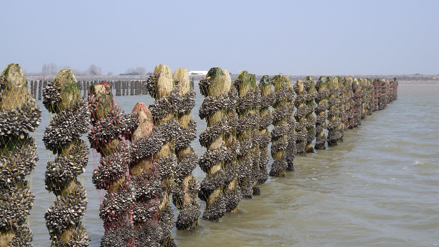
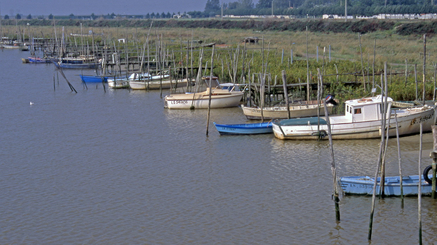
“Bouchots” mussel stakes in the Aiguillon Bay
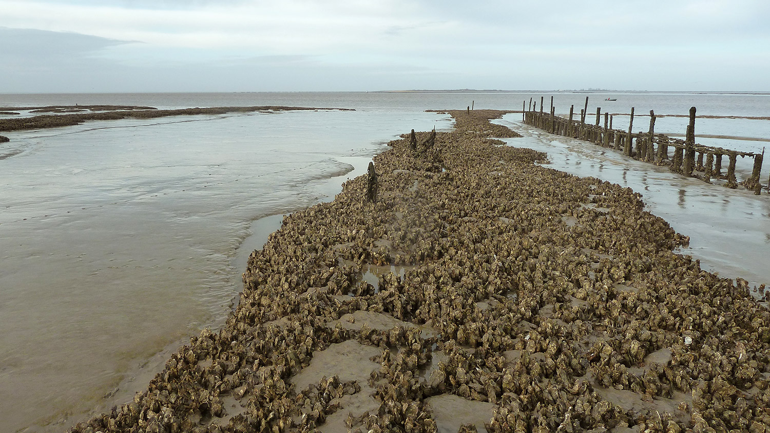
Development of wild oyster beds
Shellfish farming remains an activity compatible with the objectives of the reserve and is witness to the bay’s water quality.
THE NATIONAL NATURE RESERVE
The Aiguillon Bay and its coastal areas have been the subject of two successive classifications as National Nature Reserves. The first reserve was created by decree on July 9th, 1996 on the Vendée side. It was necessary to wait until July 2nd, 1999 for the classification of the Charente-Maritime part as a reserve.
The OFB (The French Biodiversity Agency) and the LPO (League for the Protection of Birds), appointed respectively by the Prefect of Vendée and the Prefect of Charente-Maritime (administrative authorities), ensure overall co-management of the Baie de l’Aiguillon which constitutes a single ecological entity. The two bodies are responsible for the management, scientific monitoring and development of the two reserves of the bay, subject to a single management plan. This document, approved in 2013, defines over a period of 10 years the management objectives and the long-term operational actions to be implemented.
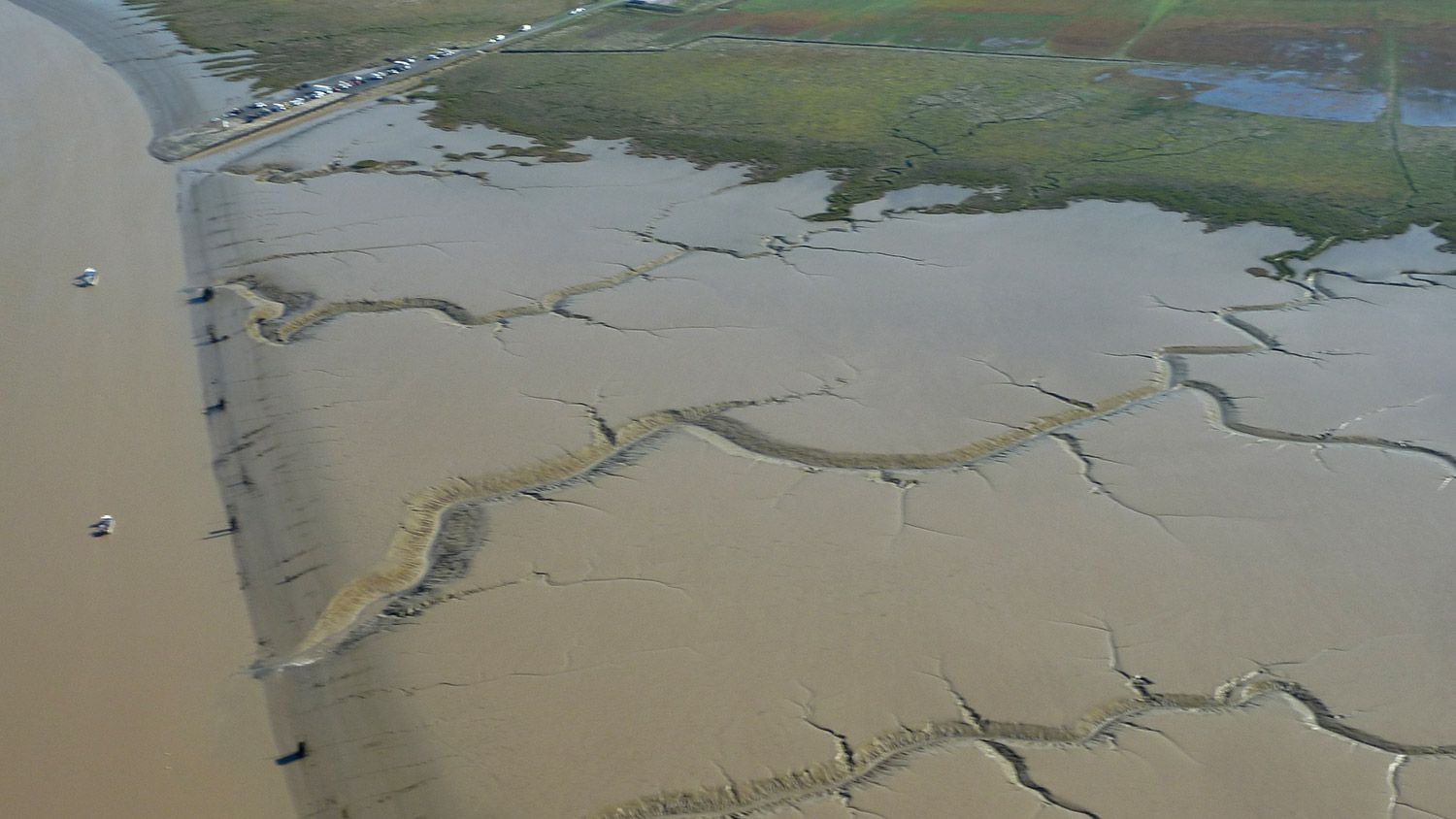
The Sèvre Niortaise estuary
![]()
The status of nature reserve is a legal means for the effective and sustainable protection of a fragile and remarkable natural area. The rule common to all nature reserves is that their area cannot be destroyed or modified. Thus, in addition to the management tool dedicated to the conservation of their natural heritage, a nature reserve is defined by the regulations contained in its decree when created.
The LIFE Baie de l'Aiguillon project is part of the actions in this management plan.
> See the Aiguillon Bay National Nature Reserve website
THE MANAGEMENT BODY OF THE MARAIS POITEVIN PNR
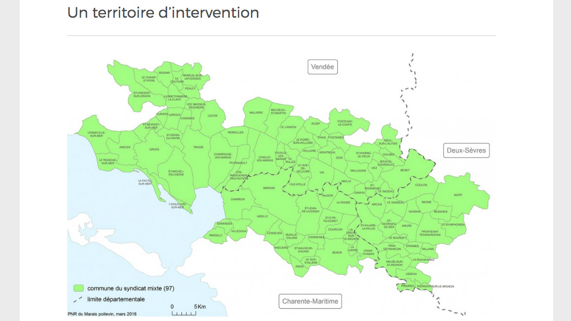
The management body of the Marais Poitevin Natural Regional Park is a mixed syndicate, made up of the two regions concerned - La nouvelle Aquitaine and Pays de la Loire, the three departments - Charente-Maritime, Deux-Sèvres and Vendée - the member municipalities, the EPCIs (Public Establishments of Intermunicipal Cooperation) and the Chambers of Agriculture. It works for the protection, restoration and enhancement of the Marais Poitevin, a wetland of international importance, in a dynamic of sustainable development.The area covered by the Marais Poitevin Natural Regional Park concerns the 93 member municipalities of the mixed syndicate.
The management tool
The Marais Poitevin Natural Regional Park Charter details the missions assigned to the Park, sets out the guidelines for the protection, promotion and development of the territory and measures to implement them over a period of 12 years.
The Natural Regional Park acts simultaneously in favour of a dynamic, a preserved and a shared Marais Poitevin. These 3 axes of the charter are developed in 18 orientations and 55 measures. All implemented actions of the Park respond to this charter.
Consult the Marais Poitevin PNR charter.
The PNR’s assignements
The Park's assignements are to:
- promote economic activities based on the enhancement of its environment
- restore natural habitats, support sustainable agriculture, preserve biodiversity and monitor its evolution
- promote land-use planning respectful of the Marais Poitevin
- make aware, educate, train and disseminate knowledge and culture of the Marais Poitevin
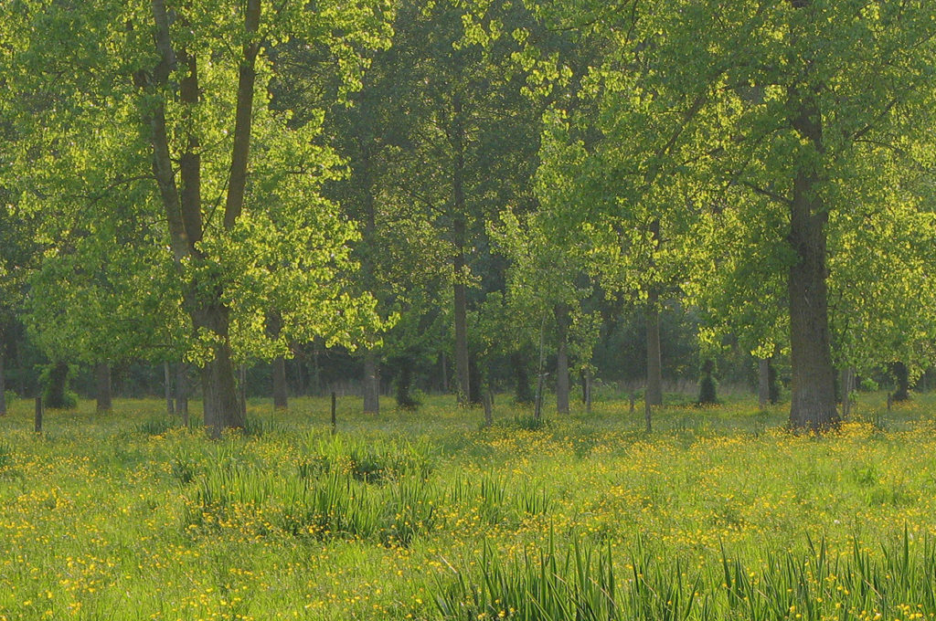
Wet water meadows © Marais Poitevin Natural Regional Park
THE OTHER POLICIES WITHIN THE MARAIS POITEVIN
The Marais Poitevin Natura 2000 site
The Aiguillon Bay is located within the area of the Marais Poitevin. This wetland covers 111,200 ha (one third of the surface of France’s Atlantic coastal marshes) and represents the second largest wetland in France after the Camargue.The Marais Poitevin is an assembly of great ecological interest for the diversity of the environments that occur and especially its wetlands. Located at the crossroads of several major climatic zones and at the interface of land and ocean it offers suitable sites for migratory birds.
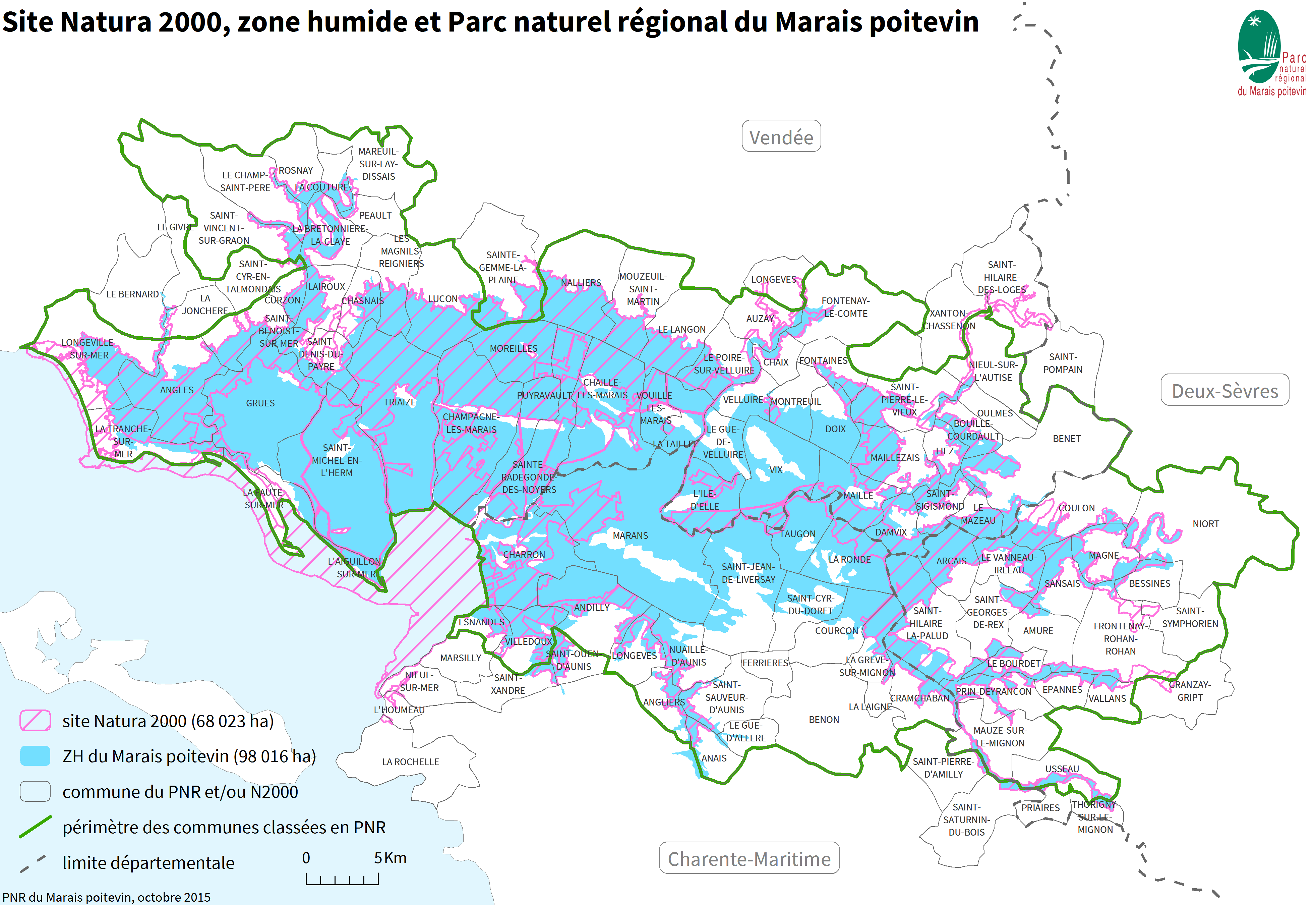
The Marais Poitevin is part of the Natura 2000 network under the "Birds" and "Habitats" Directives. The Natura 2000 site of the Marais Poitevin results from the merger of the two Special Areas of Conservation (SAC) FR 5200659 in Vendée (47,700 ha), and SAC FR 5400446 in the Deux-Sèvres and Charente Maritime departments (23,323 ha) and the Interdepartmental Special Protection Area (SPA) (FR5410100). The 68 023 ha registered within the Natura 2000 network mean that the Marais Poitevin are of international importance. The Marais Poitevin Natura 2000 site is characterized by a mosaic of interconnected, typically wetland environments: coastline, dry, intermediate and wet open marshes, water meadows and valleys, a hydraulic network, limestone islands and alluvial terraces, extensive crops on the limestone plateaus and dried-out marshes. The Baie de l’Aiguillon is integrated into the perimeter of the Natura 2000 Marais Poitevin site. Various actions of the Documents of Objectives complete the devices implemented on the Bay of Aiguillon. The LIFE Baie de l'Aiguillon operates on 5,200 ha of the Natura 2000 site: 4,900 ha in the Aiguillon Bay, 240 ha on the site of the farm of Prée Mizottière and 40 ha on the Pointe de l’Aiguillon.
“Water Development and Management Schemes” (SAGE)
The Aiguillon Bay is fed by several coastal rivers: the Lay, the Sèvre Niortaise and the Curé which drain a vast watershed of 600,000 ha. 3 SAGE have been established for the management of surface and ground water:- The Lay SAGE
- The Sèvre Niortaise and Marais Poitevin SAGE
- The Vendée river SAGE
These SAGE have been approved and are in the process of being effective. Common quantitative and qualitative management guidelines have been set up in order to better control freshwater input into the Aiguillon Bay.
For more information: - The Marais Poitevin joint syndicate, Lay bassin - The Sèvre Niortaise bassin inter-departmental institution
www.sevre-niortaise.fr/sage-sevre-niortaise-et-marais-poitevin www.sevre-niortaise.fr/sage-vendee
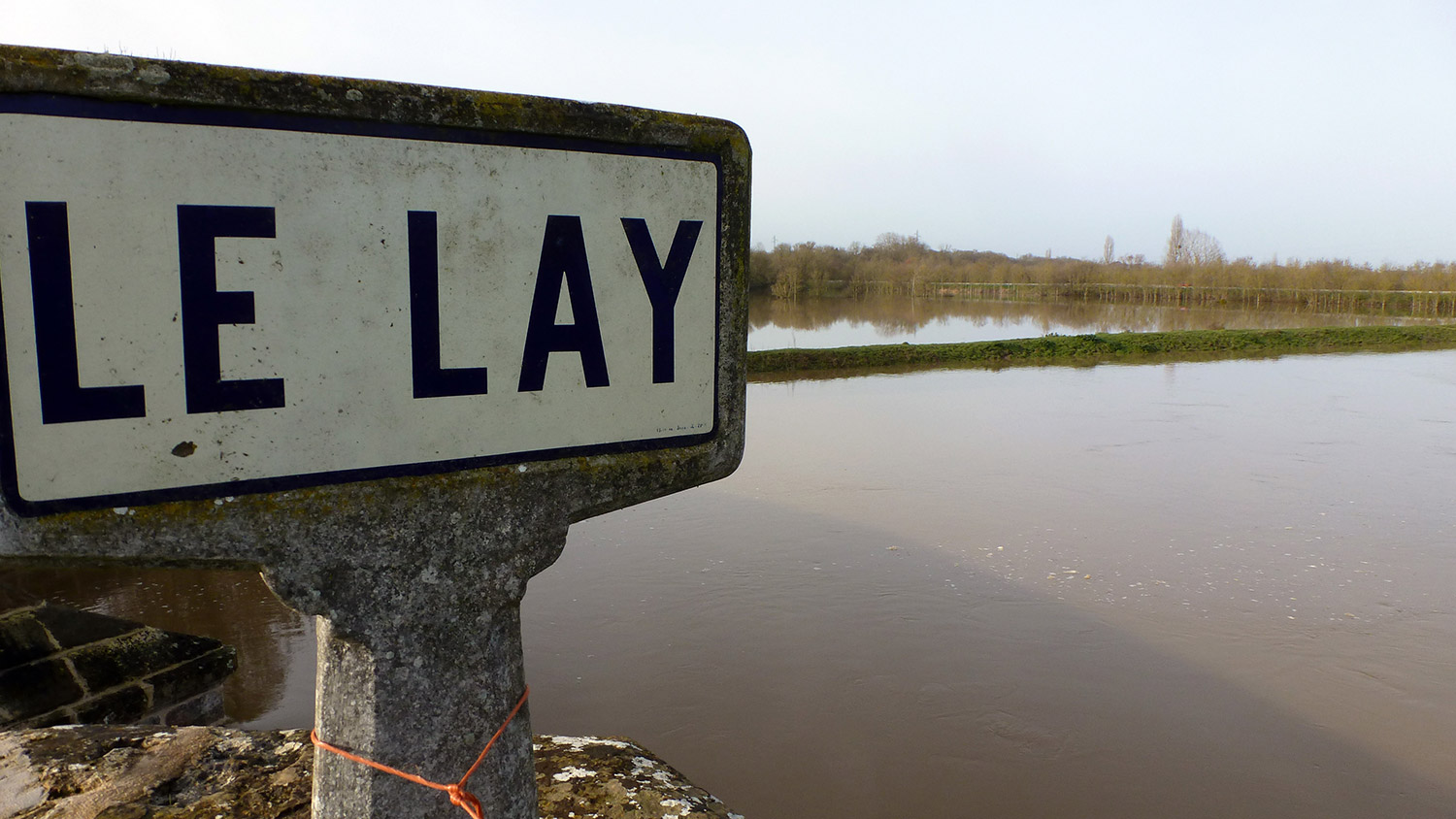
Port-la-Claye - The waters of the Lay in flood
Flood prevention action plans (PAPI)
The Aiguillon Bay is concerned by three PAPI:- The PAPI of the North Aunis in Charente Maritime, prepared by the Nord Aunis joint hydraulic syndicate (Syhna) - The Vendée Sèvre Autise PAPI, prepared by the Vendée Sèvre Autise joint syndicate - The Lay PAPI, prepared by the Marais Poitevin, Lat bassin joint syndicate
The objective of these PAPI is to define a strategy and a programme of actions to limit the risks associated with submersions and river flooding.
Government services are responsible for verifying the consistency and efficiency of the measures proposed by the three PAPI for the entire Marais Poitevin.
LIFE actions should take into account the provisions validated by each of the PAPI.
L'Aiguillon-sur-Mer port and the dyke on the Lay estuary